Volume 29, Number 4—April 2023
Research
Mapping Global Bushmeat Activities to Improve Zoonotic Spillover Surveillance by Using Geospatial Modeling
Soushieta Jagadesh , Cheng Zhao, Ranya Mulchandani, and Thomas P. Van Boeckel
Figure 2
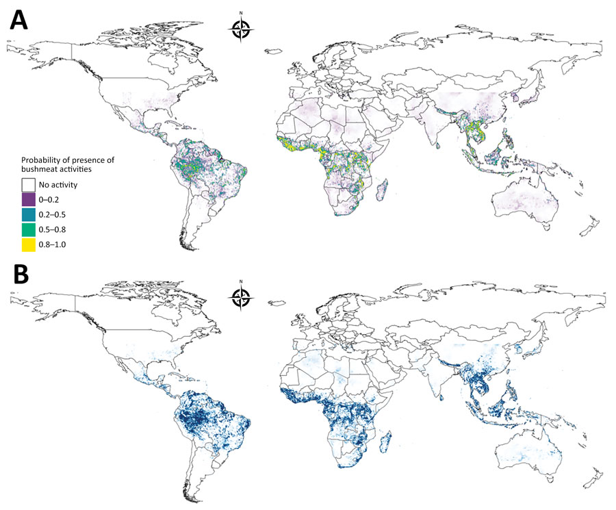
Figure 2. Model prediction and uncertainty maps for model of global bushmeat activities (hunting, preparing, and selling bushmeat) to improve zoonotic spillover surveillance. A) Distribution of bushmeat activities in the tropical and subtropical regions from an ensemble of 3 model predictions using a hierarchical binomial model with spatial autocorrelation. B) Map illustrating the uncertainty of predicted bushmeat activities represented by the SD of each pixel. Each pixel represents a 5 × 5 km area.
Page created: February 06, 2023
Page updated: March 20, 2023
Page reviewed: March 20, 2023
The conclusions, findings, and opinions expressed by authors contributing to this journal do not necessarily reflect the official position of the U.S. Department of Health and Human Services, the Public Health Service, the Centers for Disease Control and Prevention, or the authors' affiliated institutions. Use of trade names is for identification only and does not imply endorsement by any of the groups named above.